Explorer map 134
Crawley and Horsham
Easy going on cycle tracks, bridleways and country roads.
Can be (very) muddy in winter
39km |
Start GR151309 Parking at the Broadbridge
Heath leisure centre.
- Leave the car park heading north and turn
left on to the the A264. In about 400m turn left down a bridleway,
crossing the river Arun and up a track to to the Downs Link.
-
Head
north west on the Downs link for 2.5km and at
the first road junction turn right into Slinfold. 500m later, at
a road junction turn left for 200m and then take the bridleway to the west
of the church heading north.
-
Follow the bridleway uphill, on tarmac, to
Hill house then go right downhill to a fork at GR123322. Take the
left fork heading north to join the A29/A281.
-
Turn left (west) and ride like fury on this
busy main road for 300m looking out for a bridleway on your right, just
before the roundabout, and take it.
- Climb up the hill, in the gully or on the
bank. As you leave the wood turn left (north west) on a
bridleway that descends slowly, crossing a forest track, and muddily (horses got here first) for
some 3.2km to join the B2128 at Cox Green
-
Turn left to Rudgwick and take the right fork at GR09134 in
to Linwick street. After 1km and just over the railway bridge
(Downs link again) take the left hand bridleway through Woodsomes farm.
-
Follow the bridleway round to the south east
and turn left at road (Cooks hill) and over the A281 into Hornhill
lane. Join The Loxwood road at 'The Mucky Duck' turning right.
- At Crabtree corner GR060315 turn left (south)
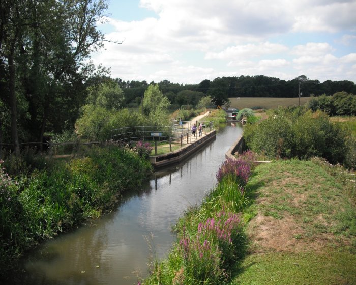
towards Drungewick. When you reach the (Wey and Arun) canal turn
onto the towpath and follow it 2km to Onslow. Turn left onto the
B2133.
- After 1.5km turn left (bridleway) towards
Drungewick. When you reach Drungewick lane turn right and after
250m left, onto a bridleway which heads southeast towards Malham.
- At Malham GR061288 turn left towards the canal and
after 1km left in to Okehurst road opposite Bignor wood. Carry on
for 2.5km to a road junction, turn right and then at the Haven GR089306
turn left on to Haven road.
- After 2km at GR084324 turn right, almost
back on yourself, to join a bridleway that leads to the Downs link.
- Tun right (south east) on to the Downs
link and follow it 4km back to the track leading back to the
Broadbridge Heath leisure centre.
- You could cross the road or ride on the bank/verge.
|
Broadbridge Heath was an outlier of Sullington, way to the south
The Downs link runs from Bramber, north through
Sussex and into Surrey to the top of St. Martha's hill. It more
or less follows the line of the railways from Shoreham to Horsham and
Horsham to Guildford.
Climbing up the hill you are following the line of Stane
street. The Roman road from Chichester to London.
Woodsomes
is a working farm; cattle by the evidence.
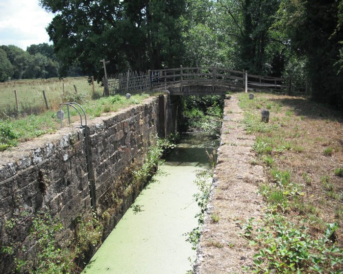
Do stop to admire the aqueduct over the river Lox.
Following the towpath you are on the Wey South path.
This is a nice quiet stretch by the canal. Watch out for
the Bull!
|