Explorer map 134
Crawley and Horsham
Easy going on cycle tracks, bridleways and country roads.
Can be (very) muddy in winter
30km |
Start GR174299 Parking at the end of Queensway (2 hours only), Horsham or at Roosthole GR209299
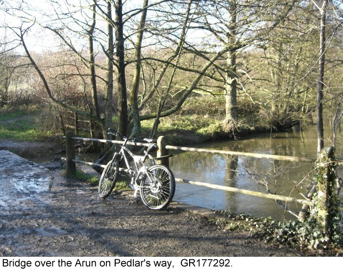
- Leave the small car park at the bottom of Queensway heading south east for
350m then turn right to cross the river Arun and ascend Denne Hill.
Cross a plateau and reach Coltstaple Lane GR169278
- Turn right for 200m and then left into Reeds
lane. After 500m turn left into Jackrell's lane. Follow the lane for a
further 2.5km (name change to Polecat lane) until the junction with
Broadwater lane, GR172252.
- Turn left for 200m and take the bridleway on the
right (eastwards), passing in front of Elliotts and through to Elliott's
farm GR180252.
- Take the left bridleway for 1.25km passing through Sedgwick park and then right (NE) through Home wood at GR185267.
- Continue through the wood emerging on the Monk's gate to Nuthurst road at GR202276.
Either turn left for the A281 and the road back to Horsham, or
- Turn right towards Nuthurst. At GR193262, just past the 'Blackhorse', turn left (eastwards) past the Ornamental Plants greenhouse and after 250m follow the bridleway left.
- After 250m turn right (south eastwards) through Lodgesale wood emerging onto Newells lane at GR207263.
- Go left for a few metres and take the bridleway south eastwards through Newell's rough. After 1km take the left hand bridle way eastwards.
- Emerging on the A281 at Lower Beeding go right for 200m and then left down Mill lane. At the end of the tarmac take the bridleway left, northwards. Follow this through Freechase Hill ending up on the Grange to the west of Warninglid GR245264.
- Turn left for 500m and then right and over the hill to GR244280. Turn left to join the B2110 at Ashfold crossways.
- Turn right onto the B2110 towards Handcross. After 800m turn left in Cartersledge lane GR246291.
This is a fast and dangerous stretch of road
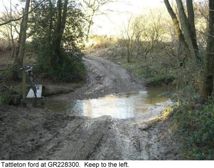
- Follow the lane for 2km, turning left through a ford at the site of Tattleton's farm GR228300, and then right to join the Grouse road.
- Turn left down the Grouse road and then right at Buck's head GR218291 onto the Hammerpond road. Follow this for 3km turning left at a 'T' junction GR189301 into St Leonards Road. Continue to the A281 at the St Leonard's 'bar and restaurant' turn right down into Horsham
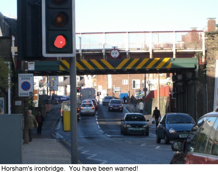
- As the 'iron bridge' comes into view look out
for Queensway on the left and the carpark at the end.
|
This lane is called 'Pedlars Way' (giddit?)
Broadwater is near Worthing; This is the northern end of a 'Greenway'.
Elliotts has the appearance of an ante-bellum southern (US) mansion; pity about the greenhouse.
Horses are trained here.
Sedwick castle in the very
private gounds was built in the reign of King Stephen.
A folksong collected at Monk's gate, 'Our
captain cried all hands'provided the tune for 'He who would valiant
be'
The ride passes along the outside of the Leonardslee estate. Watch out for wallabies!
This is iron country. Iron cast at the furnace (Slaugham) was hammered of its impurities. Ponds provided power for the waterwheels and their hammers. Read the plaque by Hawkins pond GR216292
Try the Wealden Iron Research Group for more.
Pass
under the Ironbridge and you enter Horsham's traffic system where you will have plenty of time to repent of all your earthly
sins |